A selection of our publications may now be ordered online. Follow this link to the online shop : https://www.etsy.com/uk/shop/Tunnelbreeze
More titles will shortly be added so please keep visiting.


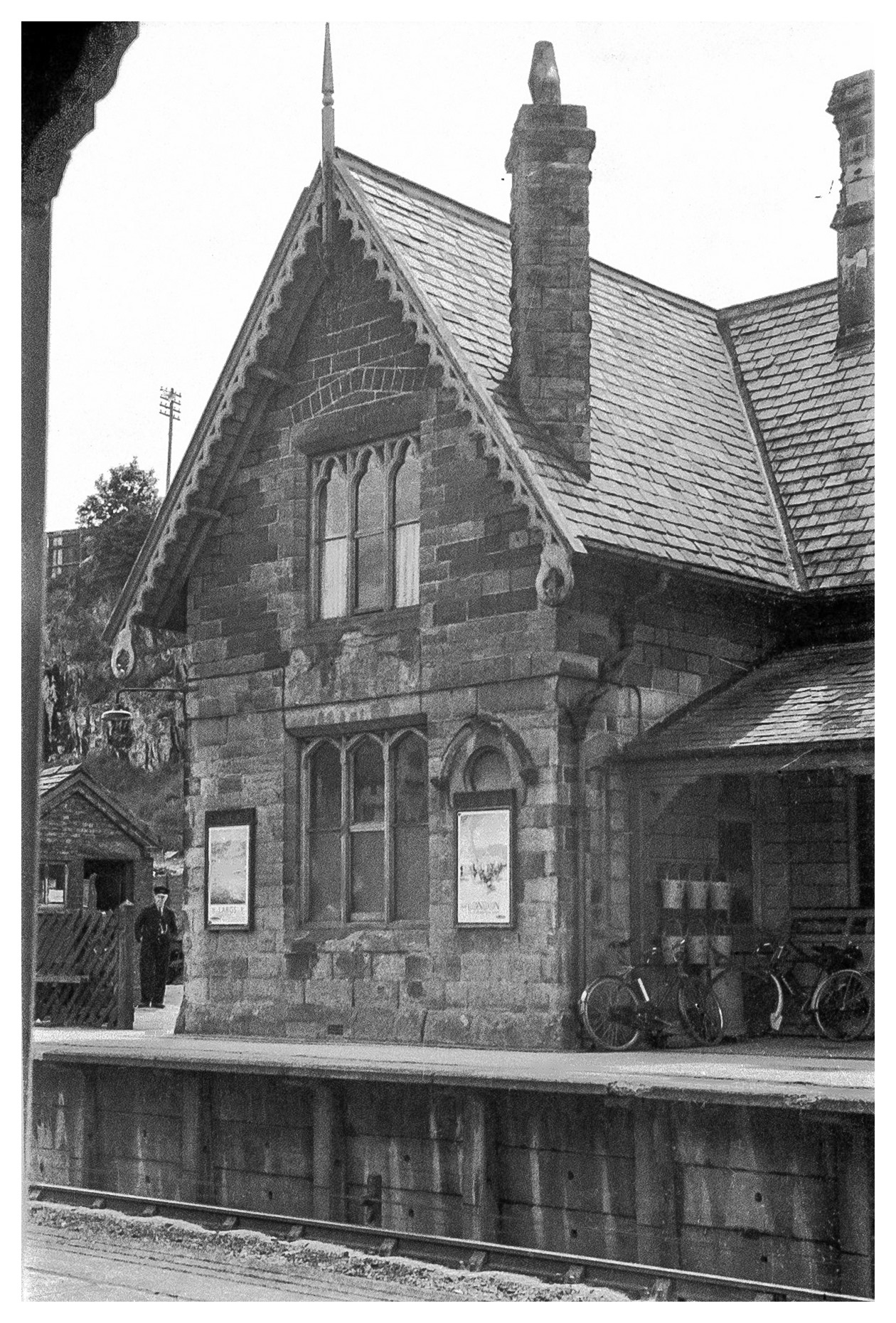
Despite its name, Peak Forest Station was three and a half kilometres from that village and was actually in Peak Dale. Opened by the Midland Railway in 1867, it was on the main line between Manchester Central and London St.Pancras. The station was served by local stopping trains with destinations of Buxton, Derby and Manchester. The line became part of the LMS system in 1923 and services increased, although most northbound trains terminated at Chinley requiring a change for Manchester. By the 1960s passenger numbers were dwindling and the station closed in March 1967. The private sidings remained and are still in use for limestone traffic. The station building is also extant and is used by DB Schenker as an office.
The photographs below are from Mark Lomas and originally came from the collections of Richard Stoodley and an anonymous donor.




Dear Friends,
I am sure you will all be very glad to know that the CRT has confirmed that a footbridge will be installed at the Toddbrook Feed Weir. This will be required to allow their staff to service new flow control systems which are now recognised as essential after the recent near disaster. The CRT has said that the footbridge will normally be available for the Public to use to cross the weir.
This is excellent news and it is a culmination of all my frustrated efforts of nearly 3 years, starting in January 2015, of negotiation with the CRT to allow a footbridge to be manufactured and installed. But after 3 years of prevarication and procedural opposition I had to give up when the CRT approval costs exceeded the cost of the footbridge and the subsequent conditions imposed by the CRT would have required the Community to provide an incalculable fund (£100-200K?) to cover 60 years or more of various imagined liabilities.
The solution was always that the CRT should simply own the footbridge as it should endorsed and underwritten by the Public Benefit ethos of the CRT Constitution and for the CRT to accept whatever liabilities the new footbridge might bring along with those of the many thousands of ancient footbridges that the CRT already owns.
So there will be a footbridge at the weir. All our efforts were not in vain, in fact, after the Dam disaster I received a verbal apology in December 2019 from by a very senior CRT manager who acknowledged that the “the CRT had treated us very badly”. The petition with nearly 400 signatures is a strong measure of Community support, plus all the footpath preparation work to avoid the low boggy ground, and especially the generous permission by the owners of Gap House to permit public use of a short path to reach the official PROW paths on their land. This was agreed at the outset in 2015, without it there would have been no point in the Project both then and now.
The bridge will be made of metal and will meet all the required specifications that the Trust will apply to cover the safety of their staff and any equipment needed to service the new weir controls. At last it will provide a safe and predictable weir crossing to connect the scenic Toddbrook valley into the extensive public footpath network. We have waited many years for this.
The existence of the ‘dry crossing’ can still be associated with David Frith as originally intended. However the bridge itself exists as a necessary engineering component of the new sluice works rather than a memorial specifically to David. Perhaps there could be a simple commemorative post nearby which the CRT might allow ? I rather hope it will become known affectionately as “Frith’s Bridge” as David Brown of PNFS has suggested, I think David would have liked that. The footbridge will provide the much needed predictable means of crossing the Todd at the weir. It will enable pleasant access to many existing PROW footpaths with relative ease.
The new bridge would in addition enable a potential ‘round the reservoir’ route but a new quite complicated path over a mile long would have to be devised and constructed. This route could not be flat or as benign as the existing reservoir path as some people hope it might be. From a preliminary survey it has to cross various walls, hedges and fences, it needs 1 or 2 additional footbridges and some drainage, also steps on a steep bank and certain other places. It has to climb high above the weir because it is impossible to hug the reservoir at that end. It could then reach the bridge by use of the existing PROW paths. The first half mile from the Dam (or a bit more) could run on CRT land which would simplify the problems somewhat. But further on negotiations would be required with 2 or 3 different landowners and two Authorities.
It is a Project in its own right involving approval by several authorities. There could be environmental protection issues, Woodland Trust and SSSI. It will have quite high organisational costs, plus material and transport costs but it will be enabled by the new footbridge and it is quite feasible.
However I am convinced that the top water level of this ‘High Risk’ reservoir should be lowered permanently by at least 1.5m. in order to relieve the pressure and loading on the 180 year old dam seriously damaged both in 1970 and 2019. This will increase the safety for the school and town considerably. This should happen for fundamental safety reasons alone, but it has a secondary minor consequence. The exposed margin of the lowered reservoir could then be exploited to provide a much more simple, open and benign route for most of the ‘circular’ path and this would eliminate some (but not all) of the difficulties and costs mentioned previously.
With kind regards,
Graham 9 March 2021
Mark Lomas has kindly sent some photographs from his collection, of railway scenes around Whaley Bridge. Many of these pictures are from the early part of the 20th century when the railway was operated by the London, North Western Railway Company.

Engine, crew and platelayers. 0-6-2 Locomotive 1590 was built in 1898 to the design of F Webb. It was withdrawn from service in June 1928


An early version of containerisation.


Mark Lomas has sent us some locomotive photographs from his collection. These engines were all used in the construction of Fernilee Reservoir during the 1930s and Kinder Reservoir between 1903 and 1911. Fernilee was built by the Derbyshire Company, Lehane McKenzie & Shand Ltd. Kinder was built for Stockport Corporation by Abram Kellet of Ealing, London.
Contractor's locomotives frequently changed hands and locations or might be hired for a limited period.


No 2 was built by Kerr Stuart & Co. Ltd of Stoke on Trent. This tiny engine was one of the "Wren" class built in large numbers between 1902 and 1930.


Two further views of No 2 at work.
For construction of Kinder Reservoir near Hayfield, a standard gauge railway was laid from Hayfield Station to the site of the dam, a distance of nearly 2 miles
/ 3 km. The railway carried both building materials and workmen. The train of four small passenger coaches was known as "The Kinder Mail".

No 6 is a standard design of Hudswell, Clarke & Company of Leeds who specialised in small industrial engines.


Mark Lomas has sent us some photographs from his collection, featurning some local railway scenes.

An unidentified loco arrives in 1938 from Buxton with a train of six coaches.


Locomotive 2382 passes Fairfield Halt on its journey to Manchester. The 2-6-4 Tank engine was built in 1932 by the L M S. The station, just outside of Buxton, only had one platform. It was built in 1907 to serve the nearby golf club. Trains arriving from Manchester would call to set down passengers but nobody was allowed to board the train. There was no service in the other direction. The station closed in 1939.


On the same line as Chee Tor, but near to Peak Forest is Great Rocks. The railway here is still operational and serves various quarries to the east of Buton. The locomotive is probably a class 4F,hundreds of whch were built between 1911 and 1941.
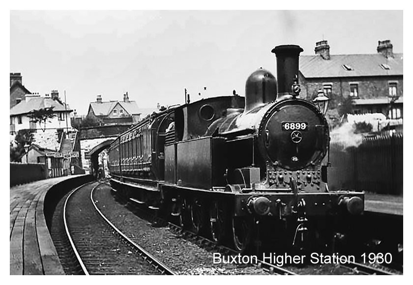
Buxton once had four railway stations. That at Higher Buxton was on the line to Ashbourne and had opened in 1894. It was never busy and closed in 1951 although passenger trains on this line continued to operate until 1954. The bridge in the background carries Clifton Road across the railway. Out of viewto the left was a goods yard. The railway is still operational, carrying limestone traffic from Dowlow Quarries. The locomotive 6899, is one of 300 built by the LNWR from 1881.


The Tithe Maps and Tithe Apportionments of the mid nineteenth century provide us with a valuable research resource. The data for Cheshire is available online: https://maps.cheshireeast.gov.uk/tithemaps/
Derbyshire maps, however, require a visit to a local library where they can be viewed on microfiche.
These were among the earliest large scale maps of England and Wales to be surveyed. The Cheshire maps are at a scale of 6 chains to one inch, approximately 1:4750; or 8 chains to one inch 1:6340
The maps indicate individual plots of land marked with a reference number. The Tithe Apportionment shows the historic field name for each plot, its ownership and the name of its occupier. These were often different as many farmers were tenants. The acreage of each field is given, together with its usage.

The Tithe system was established in the middle-ages and was a tax on agriculture in support of the church and clergy. One tenth of all produce, originally in kind would be paid each year. Many parishes had their own "tithe Barn" where these goods were collected and stored.
There were three kinds of tithe: Predial tithes were the produce of the land such as grain and vegetables. Mixed tithes were products of husbandry including lambs, calves, wool and milk. Personal tithes were the product of labour such as fishing and milling.
Predial tithes were also known as "Great tithes" and were payable to the rector. All others were known as "Small tithes" and were paid to the parish vicar.


The name "Tithe" originates from the Old English teogoþa, meaning "tenth". The practice of giving one tenth of ones income to a religious body is an ancient tradition and predates Christianity. Jesus is said to have advocated it and the practice continues to this day although usually of a voluntary basis.


